Ainley Top Coal Mines –
The Lost Mining History of Ainley, Elland
The Lost Coal Mines of Ainley Top: A Hidden Industrial History Beneath the Hillside
The mines that once shaped Ainley, Elland and the surrounding countryside
Today, Ainley Top is best known for its busy roads, the M62 and the steep descent towards Elland. Yet beneath this familiar landscape lies a much older industrial story. During the nineteenth century, the hills around Ainley Top were home to a number of small coal mines, employing local people who often combined mining with farming and other work.
The mining industry has largely disappeared from view. Fields, roads, houses and motorway infrastructure have transformed the area, but old mine workings remain underground. Historical records, geological reports and local accounts reveal a district with a surprisingly extensive coal-mining past.
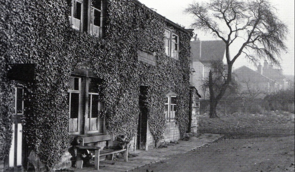
Nags Head, Ainley village
A landscape of small collieries
Mining around Ainley Top was not confined to one large colliery. Local historians records that at least seven mines operated across the wider Ainley Top area during the nineteenth century. They stretched from Birchencliffe towards Blackley and down the area now occupied by the Elland Bypass.
These were part of a wider coalfield in which small pits and local workings supplied fuel to nearby communities and industries. The coal seams around Calderdale were often relatively thin, and the district did not develop the enormous collieries found in some other parts of Yorkshire. Nevertheless, coal was an important local resource.
The Northern Mine Research Society's historical register records two mines in the Elland area under the names Ainley and Ainley Grange. Its listing gives Ainley as operating between 1888 and 1897, while Ainley Grange is recorded from 1912 to 1926, with the site noted as standing from 1915 to 1926.
These entries provide valuable evidence that mining continued in the district into the early twentieth century. They also show why it is important to distinguish between individual mine names: the wider Ainley mining district contained several separate workings, not one single colliery.
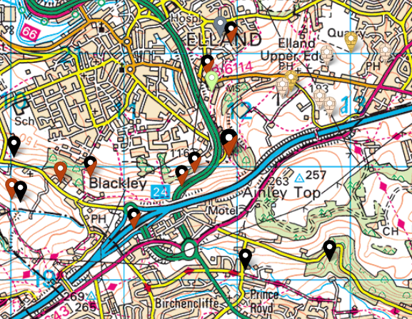
map showing mines around Ainleys
The fatal explosion of 1833
One of the most serious events in the area's mining history occurred on 30 May 1833, when an underground explosion killed five men.
The Northern Mine Research Society records the disaster at Lindley Top Colliery, then the property of James Waterhouse of Lumley. The five men who died were James Waterhouse, the lessee of the pit, Thomas Crosby of Elland, George Batley, John Tiffany and Edward Booth, both from Lumley.
A separate account of coal mining in the Huddersfield area describes the explosion as an accident involving firedamp. It reports that gunpowder used during blasting ignited the gas underground.
Firedamp is methane released from coal seams and surrounding strata. When mixed with air in the right proportions, it can explode if exposed to a naked flame or spark. Before modern ventilation, gas detection and electrical safety equipment, it was one of the greatest dangers faced by underground miners.
The accident is particularly significant because it connects the mining landscape around Ainley and Lindley with the human cost of early coal production. The surviving record also gives the names and home places of the men who lost their lives, bringing the disaster closer to the communities around the pit.
The name used in the accident record is Lindley Top Colliery. It should not automatically be treated as another name for every mine subsequently recorded as Ainley Main or Ainley Top; the exact relationship between the individual workings deserves further documentary investigation.
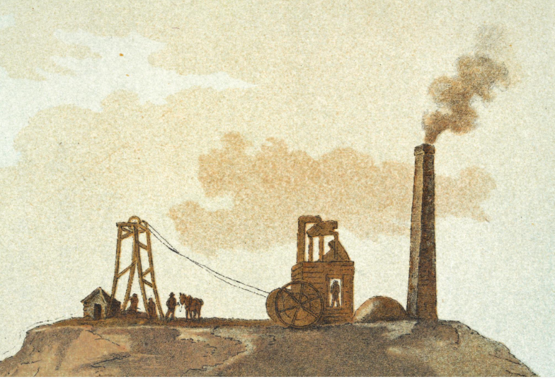
Coal, farming and village life
Mining was part of a mixed rural economy. Many people living around Ainley Top were likely to have worked in the mines as well as farming. For local households, employment could be varied and seasonal, with work on the land alongside underground labour.
The mines were relatively close to the settlements and farms that supplied their workforce. Their presence would have affected everyday life: men walking to work, the movement of coal, the hazards of shafts and underground workings, and the dependence of families on a dangerous industry.
The local landscape was not dominated by a single industrial complex. Instead, mining was spread across a number of locations, leaving a scattered legacy that can be difficult to recognise today.
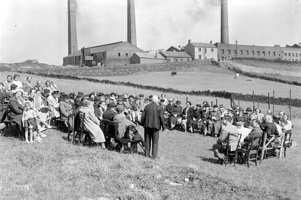
Blackley Brickworks
The 1912 miners' strike
Ainley's mining community was also caught up in the national struggle over pay and working conditions.
During 1912, miners across Britain took part in a major national coal strike. The dispute centred on the demand for a guaranteed minimum wage for underground workers. Local historical research records that mines in the Ainley area participated in the strike.
The stoppage brought the coal industry to a standstill in many districts and drew attention to the insecurity of miners' earnings. The dispute was not simply about the amount of coal produced; it concerned the basic conditions under which men risked their lives underground.
The strike is an important part of Ainley's story because it places this small local mining district within a much larger national movement. The men working in the pits around Ainley Top were part of the same industrial struggle taking place in mining communities throughout Britain.

What lies beneath Ainley Top today?
The disappearance of the visible mining industry does not mean that its workings have vanished.
A 2020 ground investigation prepared for the Ainley Top Highway Improvements scheme examined the geology and mining history beneath the area. It recorded past underground mining in the Halifax Soft Coal at a depth of approximately 56 metres beneath the investigated site. The report stated that this working had last been mined in 1861.
The same report warned of probable unrecorded shallow coal workings and identified the local coal seams and associated strata. It also discussed the possibility of fireclay workings in the district.
This is an important modern document because it demonstrates that the mining history is not simply a matter of old maps or local memory. The legacy of underground extraction remains relevant to present-day construction and ground investigations.
The report also describes the local geology, including the Hard Bed Band Coal and the 36 Yard Coal. These seams were not necessarily thick or continuous, but they formed part of the mineral resources that attracted mining activity to the area.

The old shafts did not simply disappear
A particularly striking reminder of the district's mining past came in 1958. Records from local newspaper reports of a collie dog falling down a 40-foot pit shaft and having to be rescued by a fireman using ropes.
The incident shows that old mine openings could remain a danger long after mining had ceased. Shafts and abandoned workings could become hidden beneath vegetation or be forgotten as the surrounding land changed.
It is a small story, but a revealing one. The mines were no longer part of everyday employment, yet their physical remains were still present in the landscape and could pose a risk to people and animals.

A lost industry beneath a modern transport junction
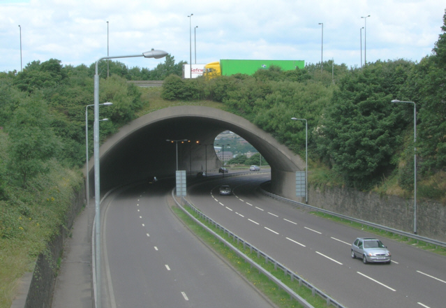
The transformation of Ainley Top during the twentieth century has made its industrial past easy to overlook. The construction of the M62, the A629 and the modern road network changed the appearance of the hillside beyond recognition.
But the mining records tell a different story. They reveal a district of scattered collieries, dangerous underground workings and families whose livelihoods were linked to coal. The 1833 explosion reminds us of the risks faced by early miners; the 1912 strike connects local workers to a national campaign for fairer conditions; and modern ground investigations show that the physical legacy remains beneath the roads and buildings.
Ainley Top may now be a place most people associate with traffic, but its history reaches much further back. Long before the motorway arrived, the hillside was a working landscape, and the mines beneath it formed an important part of the story of Ainley, Elland and the surrounding communities.
If you have enjoyed your visit to this website, please spread the word by clicking the 'like' and 'share' buttons below. Thank you