

Burnley Road, Halifax
Burnley Road is one of the historic routes leading west from Halifax, running through King Cross and Friendly before following the Calder Valley through Luddendenfoot, Mytholmroyd, Hebden Bridge and Todmorden towards Burnley in Lancashire. Its development was closely tied to the growth of turnpike roads, which improved travel and trade across the Pennines. The Halifax to Todmorden and Burnley Turnpike Road Trust was established in 1760, helping shape this important route.
Evidence of the road’s history survives in its old stone mileposts, some of which are now Grade II listed. Their carved inscriptions recorded distances to Halifax and Todmorden, sometimes with pointing hands to indicate the direction of travel. Along the route, stone cottages, former industrial buildings and historic settlements reflect the growth of communities that developed beside the road and the River Calder. Burnley Road remains an important transport corridor linking Halifax with the Calder Valley and Lancashire.


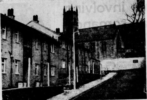
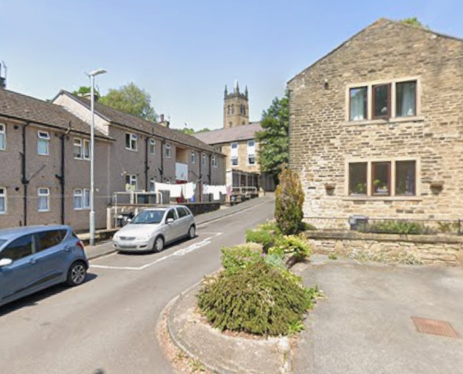
Bottom of Browfoot Lane where the cottages can be seen completed

  enhanced |
 |
 |
 |
 |
 |

  |
 |

  |
 |

Bairstow Lane
  |
 |


 |
 |


 |
 |


 |
 |
Friendly, Halifax — The Roadside Hamlet Shaped by Turnpikes, Trade and Community
A settlement along the old road west
Friendly is a small historic locality on Burnley Road, west of Halifax, in the Sowerby Bridge area of Calderdale. Rather than a large village with a clearly defined centre, it developed along an important route connecting Halifax with the Calder Valley and, eventually, Burnley. Its history is closely tied to the road itself: travellers, roadside inns, toll collection, local workshops and the houses built beside the highway all helped give Friendly its character.
The name can be confusing today because Friendly appears in several different places across Calderdale, including Ovenden and Cottonstones. This page concerns Friendly on Burnley Road, near Sowerby Bridge and Warley, where surviving historic buildings and road features provide clues to the area's past.
The turnpike road and the toll house
One of the most important influences on Friendly was the development of the turnpike road between Halifax and the western Calder Valley. The Halifax to Todmorden and Burnley Turnpike Road Trust was established in 1760, reflecting the growing importance of maintaining dependable routes for goods, livestock and passenger traffic. Before railways became the dominant means of long-distance travel, roads such as this were essential links between Halifax's textile economy and settlements further west.
Friendly's roadside history is particularly visible in the records of the Friendly Inn and Friendly Toll House. The inn stood beside the toll house, serving a road where travellers and local traffic passed through the district. The toll house later became a private residence, while the inn building has also seen changes of use. The close relationship between the two buildings illustrates how road travel could shape a small settlement: inns offered refreshment and accommodation, while toll houses were part of the system used to fund road maintenance.
The Friendly Inn and everyday life
The Friendly Inn was more than a name on an old map. Its succession of landlords, recorded across the nineteenth and twentieth centuries, provides a small but valuable record of changing local life. Names documented in the historical pub listings include William Murgatroyd in 1822 and 1861, followed by a succession of later licensees. Such records can help date photographs and identify the people associated with the building, although individual dates should be checked against trade directories and census returns before being used as definitive dates for a photograph.
The inn's later history reflects a wider change in the use of roadside premises. The historical record notes that the former inn became a deli or café bar in 2011 and was operating as a café or diner under another name in 2015. These details show the building adapting to new uses as the needs of road users and local residents changed. They should not, however, be taken as confirmation of its present-day business or trading status.
Friendly Wesleyan Chapel and the birth of the band
Friendly's history is not only about the road. A significant community landmark was the Friendly Wesleyan Methodist Chapel, built in 1837 at the junction of Burnley Road and Water Hill Lane. It became a focus for worship and community activity, with a Sunday school recorded by 1894. The chapel later closed around 1964 and was converted to private use. The surviving building offers a reminder of the importance of nonconformist chapels in the social life of nineteenth-century Calderdale.
The chapel also gave rise to one of Friendly's best-known institutions. In 1868, members of its choir formed what became the Friendly Band. According to the band's history, the founding musicians began practising in a small room near the junction of Burnley Road and Water Hill Lane, close to the White Horse Inn. Early members bought their own instruments, and the band developed through the commitment of local players and supporters.
The Friendly Band is an important thread of continuity in the locality's story. While inns changed names and uses, and the chapel ceased to serve its original purpose, the band continued as a community organisation. Its own website still identifies the Band Room on Water Hill Lane as its home, linking the present-day organisation to the place where its story began.
Stone houses and the older landscape
Friendly retains traces of an older building tradition. One particularly notable example is No. 22 Burnley Road, a Grade II listed house whose original section is thought to date from the mid-seventeenth century, with its first floor dating from the later seventeenth century. Built of local rubble stone with a stone-slate roof, it has prominent mullioned windows and other features characteristic of historic Pennine houses. An adjoining section was added in keeping with the older building in the 1980s.
The house helps place Friendly's history beyond the turnpike era. Buildings of this kind point to a landscape of small-scale settlement, where homes, farms and roadside premises developed before the large factories and dense urban streets associated with nearby industrial towns. Although one surviving house cannot tell the whole story of the locality, its age and architectural details provide a tangible connection with earlier generations.
Another distinctive feature is the early nineteenth-century milestone set into a wall on Burnley Road. Its inscriptions give distances to Todmorden, Halifax and Luddenden Foot, while carved hands indicate the directions. The milestone is Grade II listed and provides a particularly evocative reminder of the road's practical importance before modern signposts and navigation systems.
Friendly in photographs: a small place with a long memory
Friendly's character is best understood through the relationship between its road, buildings and community institutions. The turnpike connected the locality to wider commercial routes; the inn and toll house served road traffic; the chapel provided a centre for worship; and the Friendly Band created a musical tradition that outlasted many of the buildings and businesses around it.
Historic photographs can help reveal how these elements fitted together: the old road alignment, the scale and stonework of roadside buildings, the former chapel, and the familiar landmarks that gave the locality its identity. Even when a building has been altered or adapted, its position and surviving details can help connect present-day Friendly with the place earlier residents knew.
Friendly may be small, but its story is not insignificant. It preserves a record of how transport, religion and voluntary community activity shaped everyday life in the Calder Valley—and how local identity can endure even as the uses of individual buildings change.


Tuel Lane


Waiters Arms, Tuel Lane


Tuel Lane 1957

Tuel Lane Meths 1865

Tuel Lane Meths 1906
 |
 |
Tuel Lane Methodist 1934


 |
 |


 |
 |

  |
 |
If you have enjoyed your visit to this website, please spread the word by clicking the 'like' and 'share' buttons below. Thank you